
|
| ||||||||||||
|
Community and Economic Development – Blog by UNC School of Government https://ced.sog.unc.edu Student Corner: Designing a Survey of the Built EnvironmentBy CED Program Interns & StudentsPublished November 6, 2014
A previous post discussed the benefits of conducting community housing assessments for local governments and non-profit organizations interested in community and economic development. This post will discuss the methods and strategies that interested stakeholders, from local governments to neighborhood residents, can use to design and conduct assessments of the local built environment. Why assess the built environment? Conducting an “on the ground” survey of the built environment in a specific geographic area can support a number of community and economic development goals. For communities in the early stages of revitalization planning or community engagement processes, collecting data on current conditions in the built environment can help identify community assets, as well as opportunities to target resources to improve specific areas. One frequent use of data collected by this type of survey is the creation of maps; these maps can show the condition of structures, vacant lots, public infrastructure or green space in the area. Once data has been mapped, patterns may be identified that can help direct or prioritize future planning and investment. Ultimately, an assessment of the built environment will be most useful when it is aligned with larger community development goals in the area of focus. How do I plan a survey in my community? The first step in planning a survey of the built environment is defining the boundaries of the area to be surveyed – the “survey area”. Survey area boundaries may be defined by existing neighborhood or district borders, activity in an area (i.e. a downtown), natural features, existing infrastructure (i.e. highways) or other relevant factors. Survey area boundaries should be logical, but also aligned with the broad goal of the survey. For example, a survey to identify opportunities to invest home repair funds would likely include residential areas and exclude commercial areas. The size of a survey area – both in terms of area covered and number of structures/parcels included – is another important factor to consider. The larger the size, the more time, staff and/or volunteers will be needed to conduct the survey. Once survey area boundaries have been defined, specific indicators – such as building condition – can be identified for inclusion in the survey. The indicators selected will largely depend on the primary uses in the survey area, as well as the overarching goal of the survey. For example, a survey of a downtown commercial district will typically need to consider structures with multiple stories, each with a potentially different use or condition. A survey of a residential neighborhood, on the other hand, may focus on yards and green space. If the goal of the survey is to identify vacant property, specific indicators of vacancy – boarded windows, overgrown yards, for sale/rents signs – will need to be included. Surveys can also identify and evaluate public infrastructure – sidewalks, streets, lighting, transit stops – that contribute to the quality of life in an area. The chart below provides examples of indicators that might be used in a survey, as well as a potential rating scale that can be used to evaluate each indicator.
The indicators above are examples of data points that might be collected in a survey of the built environment. Surveys may be very specific (i.e. evaluating the specific condition of exterior paint) or more broad (i.e. rating the general exterior condition of a building exterior). Because conducting an on the ground assessment can be very time consuming it is generally necessary to focus on specific aspects of the built environment that are most closely linked to the broad goals of the survey, as well as the current uses in the survey area. Another important consideration is the capacity of the organization or group conducting the survey. Capacity includes the number of people conducting the survey, the type of technology being used, the time available to complete the assessment and the training of survey collectors. A large group of volunteers may be able to survey a large geographic area in a short period of time; however, each volunteer will need training and support to ensure consistency in evaluating properties. For example, if properties will be assigned a condition rating (i.e. very good, good, poor, very poor), surveyors must apply the rating consistently, so that a house rated “very good” will be in similar condition regardless of the individual that assigned the rating. The end result of successful survey plan will be a clearly defined study area, as well as a list of specific indicators that will be used to evaluate each parcel or property in the study area. How do I prepare to survey my community? Before beginning data collection, it is important to develop a survey sheet tool to collect indicator data for every property in the selected area. Though paper survey sheets and clipboards are effective in most situations, surveys conducted in large cities may require additional technology to allow for collection of information about a very large number of properties. In Detroit, a city-wide survey of vacant and abandoned buildings utilized tablet technology to allow surveyors to take pictures and text images of surveyed property to a central database. Regardless of the technology used, survey sheets need to allow for recording the same set of indicators for every building, lot or parcel in the area. Utilizing public data sources is generally the best way to compile a comprehensive list of properties in the area to be surveyed. Most local governments have publically available property data that includes address, parcel number, owner, taxable value and lot size. Additional data such as building size, use or zoning, most recent sale date/price and tax exempt status may also be available. Often, this data is available via county GIS websites that also offer mapping features and the ability to directly download property records in a selected area. Using public property data is important for a few reasons. First, data collection will be most effective and efficient if survey sheets are prepopulated with numerically ordered addresses that correspond to specific blocks or streets. For example, if addresses are out of order or streets are mixed-up, a surveyor may have to spend time searching through pages of records or retracing their steps to survey missed properties. Especially when significant numbers of properties or large geographic areas are surveyed, spending upfront time to organize addresses on survey sheets to match physical location will streamline data collection. Using public property data is also important if maps of the data collected in the survey will be created. The creation of a GIS map requires that a unique identifier be used to join spatial data (usually available from the local municipality or county) with data collected during a survey. Local government staff, often from a GIS or planning department, may be able to provide support in identifying the best common identifier, as well as in the post-collection mapping process. Another potential source of GIS mapping support is the academic community; students studying planning and geography often have the expertise and tools needed to create such maps. The final step before beginning data collection is training survey collectors to ensure consistent evaluation of property. Especially when data is based on a subjective rating such as current condition (i.e. rate the property on a scale of 1-4 or very good to very poor), it is important that surveyors are consistently applying each rating option. One strategy to encourage consistency is to look at photographs of houses with the entire survey team and discuss appropriate ratings for each photo shown. Another strategy, which generally works best with a small number of surveyors, is to start the survey as a group and talk through each rating for the first few blocks. It can also be helpful to provide a written definition of each rating category, as well as pictures or examples of houses that fit each rating. Ensuring consistent application of rating standards is vital to the credibility of the survey results, as well as recommendations made on the basis of survey findings. How do I conduct a survey in my community? The degree to which data collection is successful will largely depend on the quality of prior planning and preparation. High quality preparation can generally ensure that collection is efficient and resulting data is accurate. The actual collection process will need to be flexible to accommodate the size and safety of the survey area, experience of those collecting data, weather or environmental factors, as well as many other considerations specific to the area and community in which a survey will be conducted. For example, in areas where safety concerns exist, surveys may be conducted in teams and/or only during daytime hours. Teams can also be useful when those with less experience want to participate in the survey process, but may not be ready to start evaluating properties independently. One general rule, regardless of survey specifics, is to have all survey sheets returned to someone who will be responsible for immediately copying and/or digitizing. To allow in-depth analysis of survey data collected, data is generally converted to electronic spreadsheet form as soon as possible following collection. Digitization will also be necessary if GIS maps are to be created from survey data. Ultimately, analysis and display of data collected will be most powerful when combined with existing public property data, including tax assessed value, owner, property size. Combining publicly available data with data collected during a survey will allow for unique analysis and understanding of current conditions, as well as opportunities to improve the survey area. Surveys of the built environment offer interested stakeholders a way to understand the conditions on the ground in a specific geographic area. Surveys can also be used in involve residents from the area to be surveyed in a public process to identify assets and opportunities for investment. Taking the time to plan and prepare for conducting a survey will help ensure that data collection is both efficient and effective. Careful preparation will also help ensure that results and recommendations as a result of a survey of the built environment are credible and useful in achieving larger community development goals. Have you conducted a survey of the built environment? What lessons would you share with others interested in surveying an area in their community? Michelle Audette-Bauman is candidate in the Master of City and Regional Planning program at UNC-Chapel Hill and a Fellow with the Development Finance Initiative. | ||||||||||||
Published November 6, 2014 By CED Program Interns & Students
A previous post discussed the benefits of conducting community housing assessments for local governments and non-profit organizations interested in community and economic development. This post will discuss the methods and strategies that interested stakeholders, from local governments to neighborhood residents, can use to design and conduct assessments of the local built environment.
Why assess the built environment?
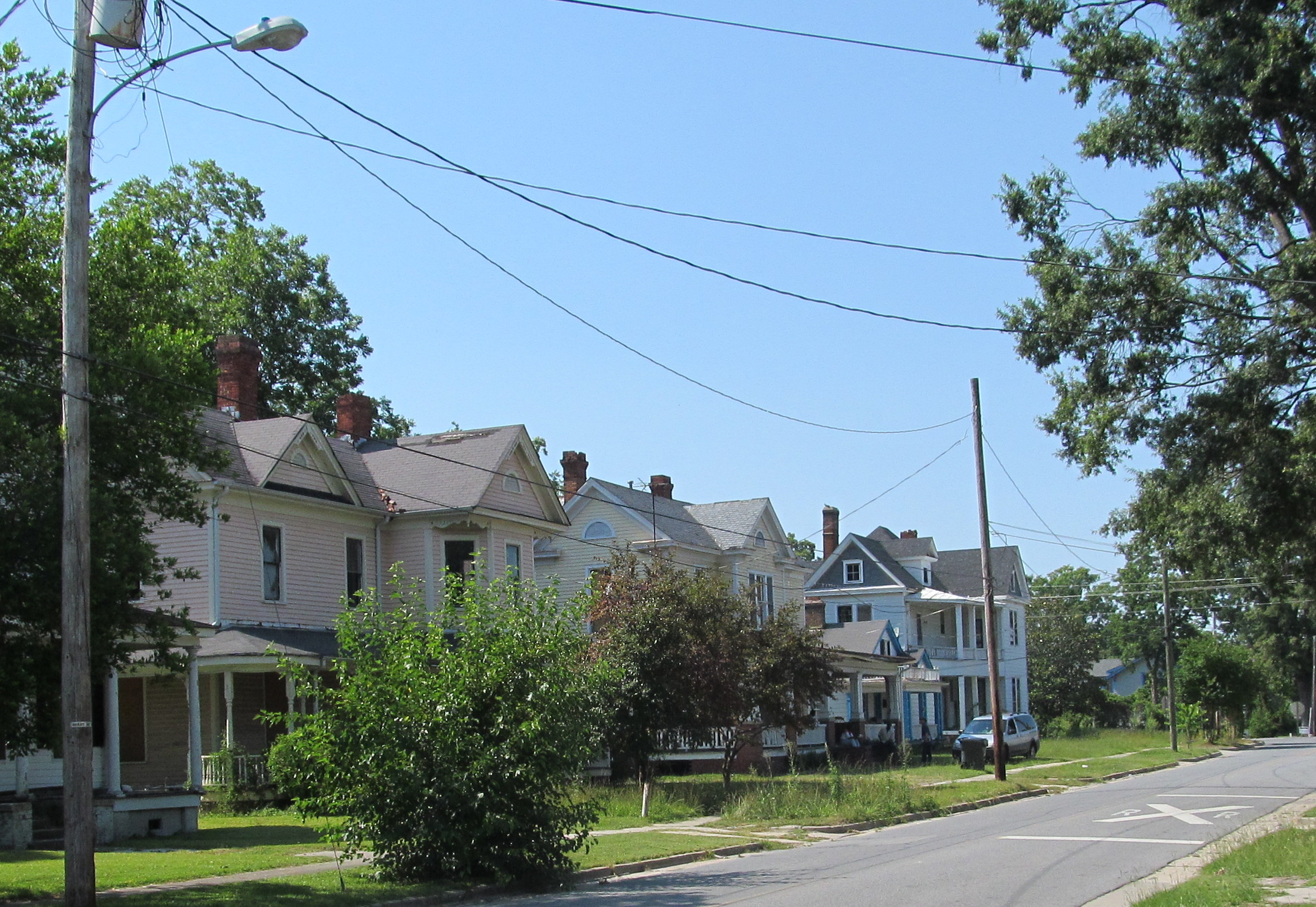
Conducting an “on the ground” survey of the built environment in a specific geographic area can support a number of community and economic development goals. For communities in the early stages of revitalization planning or community engagement processes, collecting data on current conditions in the built environment can help identify community assets, as well as opportunities to target resources to improve specific areas. One frequent use of data collected by this type of survey is the creation of maps; these maps can show the condition of structures, vacant lots, public infrastructure or green space in the area. Once data has been mapped, patterns may be identified that can help direct or prioritize future planning and investment. Ultimately, an assessment of the built environment will be most useful when it is aligned with larger community development goals in the area of focus.
How do I plan a survey in my community?
The first step in planning a survey of the built environment is defining the boundaries of the area to be surveyed – the “survey area”. Survey area boundaries may be defined by existing neighborhood or district borders, activity in an area (i.e. a downtown), natural features, existing infrastructure (i.e. highways) or other relevant factors. Survey area boundaries should be logical, but also aligned with the broad goal of the survey. For example, a survey to identify opportunities to invest home repair funds would likely include residential areas and exclude commercial areas. The size of a survey area – both in terms of area covered and number of structures/parcels included – is another important factor to consider. The larger the size, the more time, staff and/or volunteers will be needed to conduct the survey.
Once survey area boundaries have been defined, specific indicators – such as building condition – can be identified for inclusion in the survey. The indicators selected will largely depend on the primary uses in the survey area, as well as the overarching goal of the survey. For example, a survey of a downtown commercial district will typically need to consider structures with multiple stories, each with a potentially different use or condition. A survey of a residential neighborhood, on the other hand, may focus on yards and green space. If the goal of the survey is to identify vacant property, specific indicators of vacancy – boarded windows, overgrown yards, for sale/rents signs – will need to be included. Surveys can also identify and evaluate public infrastructure – sidewalks, streets, lighting, transit stops – that contribute to the quality of life in an area.
The chart below provides examples of indicators that might be used in a survey, as well as a potential rating scale that can be used to evaluate each indicator.
| Examples of Built Environment Survey Indicators | ||
| Condition (numeric scale) |
Use (residential, retail, office, etc.) |
Sidewalks (yes/no; condition) |
| Vacant (yes/no) |
Exterior upkeep(numeric scale) | Streetlights (working/not working) |
| Boarded Windows(yes/no) | Appears Historic(yes/no) | Greenspace (yes/no; condition) |
The indicators above are examples of data points that might be collected in a survey of the built environment. Surveys may be very specific (i.e. evaluating the specific condition of exterior paint) or more broad (i.e. rating the general exterior condition of a building exterior). Because conducting an on the ground assessment can be very time consuming it is generally necessary to focus on specific aspects of the built environment that are most closely linked to the broad goals of the survey, as well as the current uses in the survey area.
Another important consideration is the capacity of the organization or group conducting the survey. Capacity includes the number of people conducting the survey, the type of technology being used, the time available to complete the assessment and the training of survey collectors. A large group of volunteers may be able to survey a large geographic area in a short period of time; however, each volunteer will need training and support to ensure consistency in evaluating properties. For example, if properties will be assigned a condition rating (i.e. very good, good, poor, very poor), surveyors must apply the rating consistently, so that a house rated “very good” will be in similar condition regardless of the individual that assigned the rating. The end result of successful survey plan will be a clearly defined study area, as well as a list of specific indicators that will be used to evaluate each parcel or property in the study area.
How do I prepare to survey my community?
Before beginning data collection, it is important to develop a survey sheet tool to collect indicator data for every property in the selected area. Though paper survey sheets and clipboards are effective in most situations, surveys conducted in large cities may require additional technology to allow for collection of information about a very large number of properties. In Detroit, a city-wide survey of vacant and abandoned buildings utilized tablet technology to allow surveyors to take pictures and text images of surveyed property to a central database. Regardless of the technology used, survey sheets need to allow for recording the same set of indicators for every building, lot or parcel in the area.
Utilizing public data sources is generally the best way to compile a comprehensive list of properties in the area to be surveyed. Most local governments have publically available property data that includes address, parcel number, owner, taxable value and lot size. Additional data such as building size, use or zoning, most recent sale date/price and tax exempt status may also be available. Often, this data is available via county GIS websites that also offer mapping features and the ability to directly download property records in a selected area.
Using public property data is important for a few reasons. First, data collection will be most effective and efficient if survey sheets are prepopulated with numerically ordered addresses that correspond to specific blocks or streets. For example, if addresses are out of order or streets are mixed-up, a surveyor may have to spend time searching through pages of records or retracing their steps to survey missed properties. Especially when significant numbers of properties or large geographic areas are surveyed, spending upfront time to organize addresses on survey sheets to match physical location will streamline data collection.
Using public property data is also important if maps of the data collected in the survey will be created. The creation of a GIS map requires that a unique identifier be used to join spatial data (usually available from the local municipality or county) with data collected during a survey. Local government staff, often from a GIS or planning department, may be able to provide support in identifying the best common identifier, as well as in the post-collection mapping process. Another potential source of GIS mapping support is the academic community; students studying planning and geography often have the expertise and tools needed to create such maps.
The final step before beginning data collection is training survey collectors to ensure consistent evaluation of property. Especially when data is based on a subjective rating such as current condition (i.e. rate the property on a scale of 1-4 or very good to very poor), it is important that surveyors are consistently applying each rating option. One strategy to encourage consistency is to look at photographs of houses with the entire survey team and discuss appropriate ratings for each photo shown. Another strategy, which generally works best with a small number of surveyors, is to start the survey as a group and talk through each rating for the first few blocks. It can also be helpful to provide a written definition of each rating category, as well as pictures or examples of houses that fit each rating. Ensuring consistent application of rating standards is vital to the credibility of the survey results, as well as recommendations made on the basis of survey findings.
How do I conduct a survey in my community?
The degree to which data collection is successful will largely depend on the quality of prior planning and preparation. High quality preparation can generally ensure that collection is efficient and resulting data is accurate. The actual collection process will need to be flexible to accommodate the size and safety of the survey area, experience of those collecting data, weather or environmental factors, as well as many other considerations specific to the area and community in which a survey will be conducted. For example, in areas where safety concerns exist, surveys may be conducted in teams and/or only during daytime hours. Teams can also be useful when those with less experience want to participate in the survey process, but may not be ready to start evaluating properties independently.
One general rule, regardless of survey specifics, is to have all survey sheets returned to someone who will be responsible for immediately copying and/or digitizing. To allow in-depth analysis of survey data collected, data is generally converted to electronic spreadsheet form as soon as possible following collection. Digitization will also be necessary if GIS maps are to be created from survey data. Ultimately, analysis and display of data collected will be most powerful when combined with existing public property data, including tax assessed value, owner, property size. Combining publicly available data with data collected during a survey will allow for unique analysis and understanding of current conditions, as well as opportunities to improve the survey area.
Surveys of the built environment offer interested stakeholders a way to understand the conditions on the ground in a specific geographic area. Surveys can also be used in involve residents from the area to be surveyed in a public process to identify assets and opportunities for investment. Taking the time to plan and prepare for conducting a survey will help ensure that data collection is both efficient and effective. Careful preparation will also help ensure that results and recommendations as a result of a survey of the built environment are credible and useful in achieving larger community development goals.
Have you conducted a survey of the built environment? What lessons would you share with others interested in surveying an area in their community?
Michelle Audette-Bauman is candidate in the Master of City and Regional Planning program at UNC-Chapel Hill and a Fellow with the Development Finance Initiative.
Author(s)
Tagged Under
This blog post is published and posted online by the School of Government to address issues of interest to government officials. This blog post is for educational and informational Copyright ©️ 2009 to present School of Government at the University of North Carolina. All rights reserved. use and may be used for those purposes without permission by providing acknowledgment of its source. Use of this blog post for commercial purposes is prohibited. To browse a complete catalog of School of Government publications, please visit the School’s website at www.sog.unc.edu or contact the Bookstore, School of Government, CB# 3330 Knapp-Sanders Building, UNC Chapel Hill, Chapel Hill, NC 27599-3330; e-mail sales@sog.unc.edu; telephone 919.966.4119; or fax 919.962.2707.